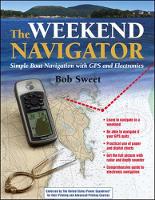
Weekend Navigator
 portes grátis
Weekend Navigator
Sweet, Robert
McGraw-Hill Education - Europe
09/2004
272
Mole
Inglês
9780071430357
0071430350
15 a 20 dias
762
Useful for inland and coastal cruisers, sportfishers, and aspiring recreational boaters, this handbook features a quick-reference format that helps you operate your GPS, depth sounder, and radar and interpret what they tell you. Containing 300 full-colour illustrations, it shows how to use your electronics to navigate safely in all conditions.
AcknowledgmentsPart I--IntroductionChapter 1--About this BookNavigating this BookChapter 2--What Is Navigation?The Three Steps of NavigationPiloting without ElectronicsChapter 3--Fundamentals of Waypoint NavigationSample Cruise RevisitedMore on GPSOther Uses for WaypointsChapter 4--The Tools of NavigationNautical ChartsPlotting ToolsOther Navigation ToolsPart II--Prevoyage PlanningChapter 5--Planning with GPS and Paper ChartsPlanning and Paper ChartsPlotting on a ChartEntering Waypoints into Your GPSChapter 6--Planning with Digital ChartsDigital ChartsCruise-Planning SoftwareChart-Planning Software FeaturesWorking with Digital ChartsChartplottersPDAsPlanning for SailingChapter 7--Planning to Avoid DangerDefine the AreaMark the ObstaclesMark LandmarksPart III--Navigating UnderwayChapter 8--Underway with GPS and Paper ChartsSteps in Waypoint NavigationStaying On CourseNavigating a Route with GPSNavigating in a RegionMarking ObjectsKeeping TrackChapter 9--Underway with Digital ChartsUsing the Chartplotter UnderwayUsing a Computer and GPS UnderwayPDAs and Pocket PCsThe Future of Onboard ComputersPart IV--Double-Checking Your NavigationChapter 10--Double-Checking Using InstrumentsQuick ObservationsMore Accurate BearingsChapter 11--Eye of the MarinerHeadingsRangesBearingsCollision BearingsPart V--Responding to Changing ConditionsChapter 12--What to Do If the GPS QuitsStop and RegroupPlan Before ProceedingNavigating without GPSChapter 13--Planning as You Go with GPSFind Where You ArePlot a Safe Path to the New DestinationChapter 14--Tides, Winds, and CurrentsAbout Tides and Tidal CurrentsAdjusting for Tides and Tidal CurrentsOcean CurrentsWind, Waves, and Other Unpredictable EffectsPart VI--Other ElectronicsChapter 15--Navigating with RadarRange Settings for Recreational BoatersRadar DisplayCollision AvoidanceRadar NavigationTracking WeatherChapter 16--Using Depth in NavigationDepth Sounders versus Sonars and FishfindersNavigating with a Depth SounderChapter 17--Using Radio in NavigationIn an EmergencyWeather RadioFixed versus Handheld VHFChapter 18--Using an Electronic CompassTypes of Electronic CompassesUsing the Electronic Compass for NavigationChapter 19--Using an Autopilot in NavigationNavigating with an AutopilotPart VII--Special TechniquesChapter 20--Navigating While Tacking into the WindGetting the Most Out of Each TackChartplotters and Navigation SoftwareChapter 21--Navigating Harbors and Channels with ElectronicsGood VisibilityLimited VisibilityChapter 22--Navigating under Adverse ConditionsLimited VisibilityWind and SeaChapter 23--A Last Word on Avoiding DangerElectronic AlarmsVisual ObservationsUsing RadarChapter 24--Advanced Topics in RadarHow Marine Radar Does Its JobInstallation and AlignmentRadar ControlsChapter 25--Other InstrumentationInstrumentsChapter 26--Connecting It All TogetherBasic InterconnectionsHigher-Speed ConnectionsChapter 27--Electronic Navigation Tools and Rules--A SummaryEquipment Priority ListChecklistChapter 28--Measuring Compass Deviation Using GPSAccurate Compass NavigationDetermining DeviationMeasuring Deviation While You CruiseAppendix 1--Using the Maptech Digital Chart CDAppendix 2--GPS Display Overview--A Side-by-Side ComparisonAppendix 3--Resources and ReferencesIndex
Este título pertence ao(s) assunto(s) indicados(s). Para ver outros títulos clique no assunto desejado.

