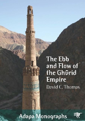
Ebb and Flow of the Ghrid Empire
 portes grátis
Ebb and Flow of the Ghrid Empire
Thomas, David C.
Sydney University Press
05/2018
338
Mole
Inglês
9781743325414
15 a 20 dias
400
Descrição não disponível.
List of figures
List of plates
List of tables
Abstract in Dari
Acknowledgements
Preface
Note on transliteration and dates
Abbreviations
Introduction
1. The nomadic empire of the Ghurids
2. The Ghurid landscapes
3. The rise, expansion and demise of the Ghurids under the Shansabanid dynasty
4. The archaeological remains of the Ghurids
5. Exploring Jam
6. Re-defining Jam: an archaeological eye in the sky
7. The Ghurids: an unsustainable Early Islamic polity
Plates
Appendix 1: Google Earth study areas
Appendix 2: less well-known ethnies and dynasties
Works cited
Index
Supplementary appendices
Appendix 3: Ghurid sites
Appendix 4: Architectural details of sites and structures recorded by MJAP in 2003 and 2005
Appendix 5: MJAP robber hole data
Appendix 6: MJAP robber holes
Appendix 7: Excavated contexts, MJAP 2003 and 2005
Appendix 8: Small finds, MJAP 2003 and 2005
Appendix 9: X-Ray Fluorescence (XRF) data
Appendix 10: Environmental data
Appendix 11: Descriptions of Ghurid sites analysed in high-resolution satellite images available through Google Earth
Appendix 12: Descriptions of selected Ghurid sites analysed using upgraded satellite images available through Google Earth
Appendix 13: ASAGE sites referred to in Chapter 7
Appendix 14: Summary data for all the ASAGE sites
Este título pertence ao(s) assunto(s) indicados(s). Para ver outros títulos clique no assunto desejado.
Archaeology; Minaret; Google Earth; Ghurids; Afghanistan
List of figures
List of plates
List of tables
Abstract in Dari
Acknowledgements
Preface
Note on transliteration and dates
Abbreviations
Introduction
1. The nomadic empire of the Ghurids
2. The Ghurid landscapes
3. The rise, expansion and demise of the Ghurids under the Shansabanid dynasty
4. The archaeological remains of the Ghurids
5. Exploring Jam
6. Re-defining Jam: an archaeological eye in the sky
7. The Ghurids: an unsustainable Early Islamic polity
Plates
Appendix 1: Google Earth study areas
Appendix 2: less well-known ethnies and dynasties
Works cited
Index
Supplementary appendices
Appendix 3: Ghurid sites
Appendix 4: Architectural details of sites and structures recorded by MJAP in 2003 and 2005
Appendix 5: MJAP robber hole data
Appendix 6: MJAP robber holes
Appendix 7: Excavated contexts, MJAP 2003 and 2005
Appendix 8: Small finds, MJAP 2003 and 2005
Appendix 9: X-Ray Fluorescence (XRF) data
Appendix 10: Environmental data
Appendix 11: Descriptions of Ghurid sites analysed in high-resolution satellite images available through Google Earth
Appendix 12: Descriptions of selected Ghurid sites analysed using upgraded satellite images available through Google Earth
Appendix 13: ASAGE sites referred to in Chapter 7
Appendix 14: Summary data for all the ASAGE sites
List of plates
List of tables
Abstract in Dari
Acknowledgements
Preface
Note on transliteration and dates
Abbreviations
Introduction
1. The nomadic empire of the Ghurids
2. The Ghurid landscapes
3. The rise, expansion and demise of the Ghurids under the Shansabanid dynasty
4. The archaeological remains of the Ghurids
5. Exploring Jam
6. Re-defining Jam: an archaeological eye in the sky
7. The Ghurids: an unsustainable Early Islamic polity
Plates
Appendix 1: Google Earth study areas
Appendix 2: less well-known ethnies and dynasties
Works cited
Index
Supplementary appendices
Appendix 3: Ghurid sites
Appendix 4: Architectural details of sites and structures recorded by MJAP in 2003 and 2005
Appendix 5: MJAP robber hole data
Appendix 6: MJAP robber holes
Appendix 7: Excavated contexts, MJAP 2003 and 2005
Appendix 8: Small finds, MJAP 2003 and 2005
Appendix 9: X-Ray Fluorescence (XRF) data
Appendix 10: Environmental data
Appendix 11: Descriptions of Ghurid sites analysed in high-resolution satellite images available through Google Earth
Appendix 12: Descriptions of selected Ghurid sites analysed using upgraded satellite images available through Google Earth
Appendix 13: ASAGE sites referred to in Chapter 7
Appendix 14: Summary data for all the ASAGE sites
Este título pertence ao(s) assunto(s) indicados(s). Para ver outros títulos clique no assunto desejado.

